- 01
- 02
- 03
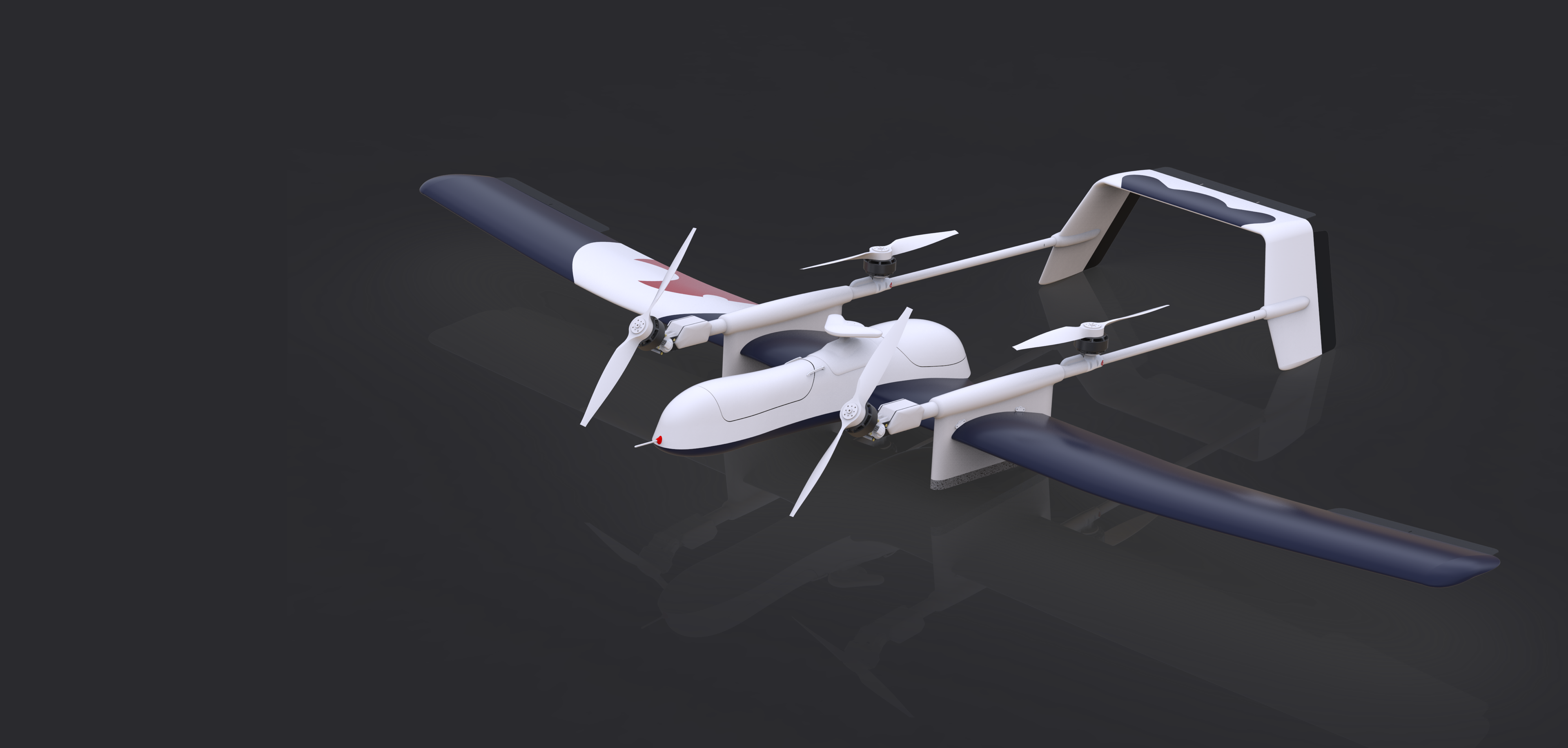
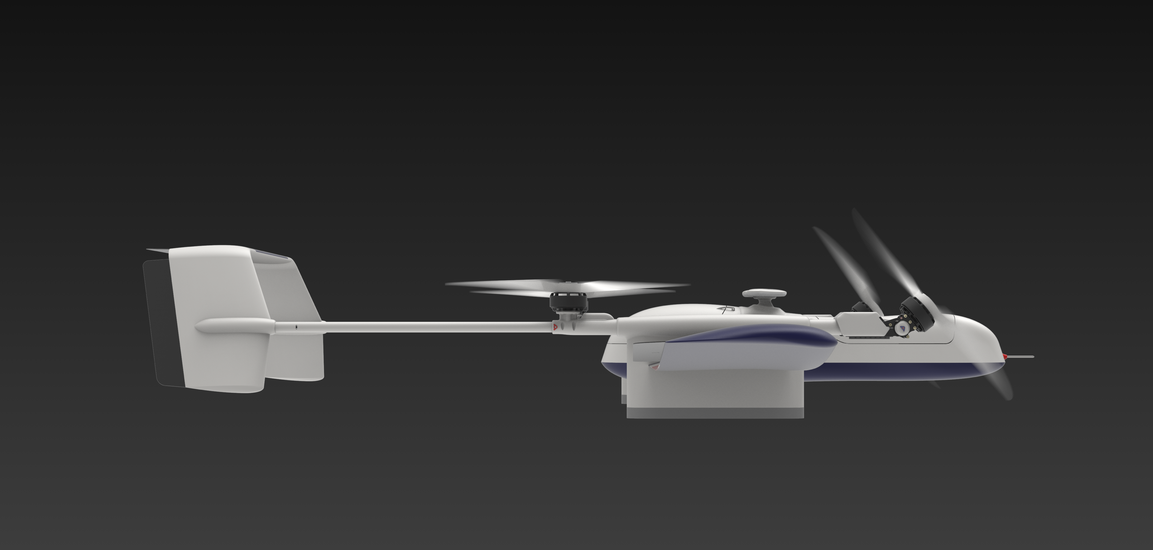
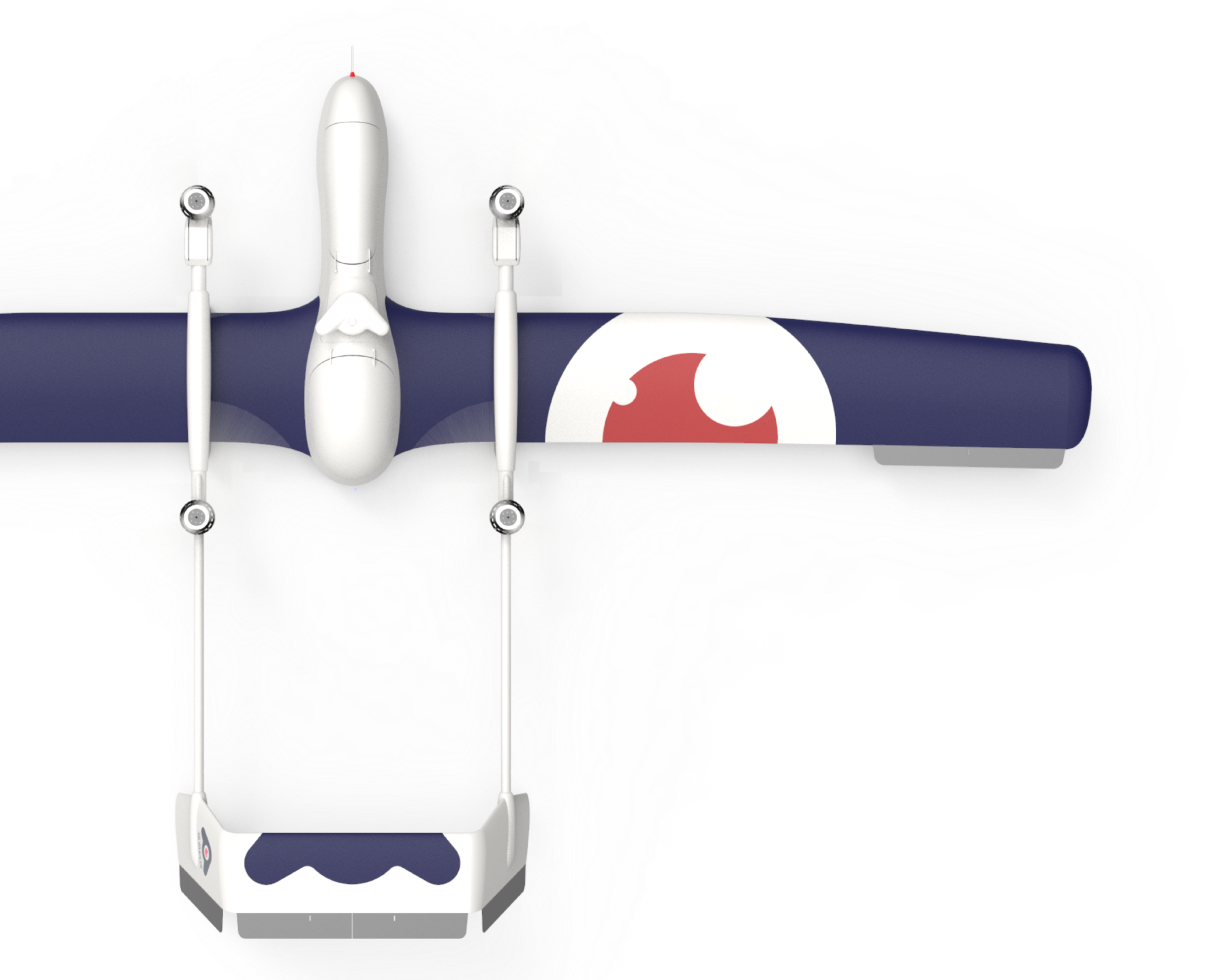
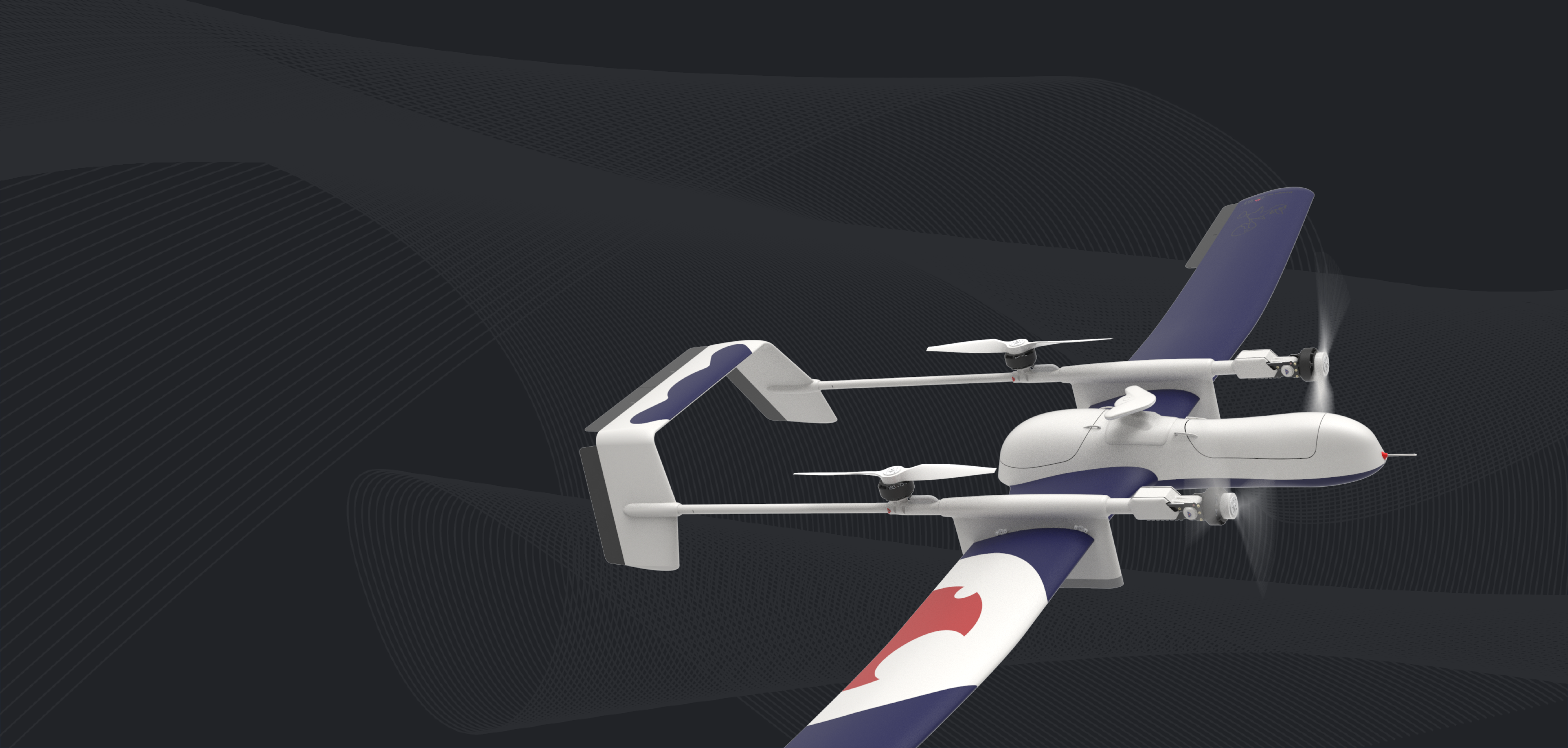
UGLY-DUCKLING 2.0
Tilt-rotor Unmanned
Aircraft with Vertical
Take-off and Landing Capability
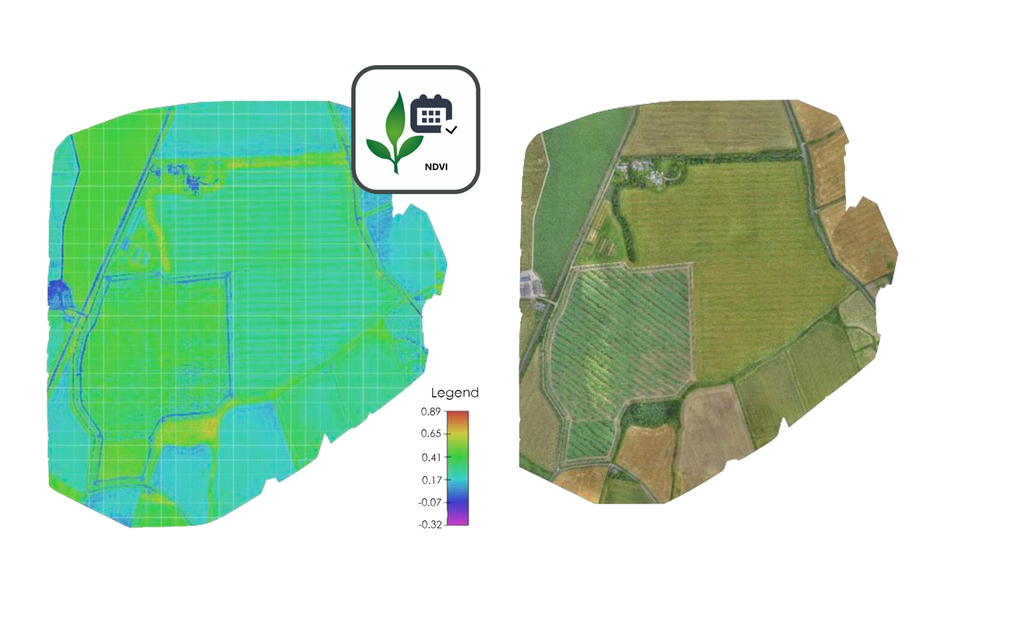
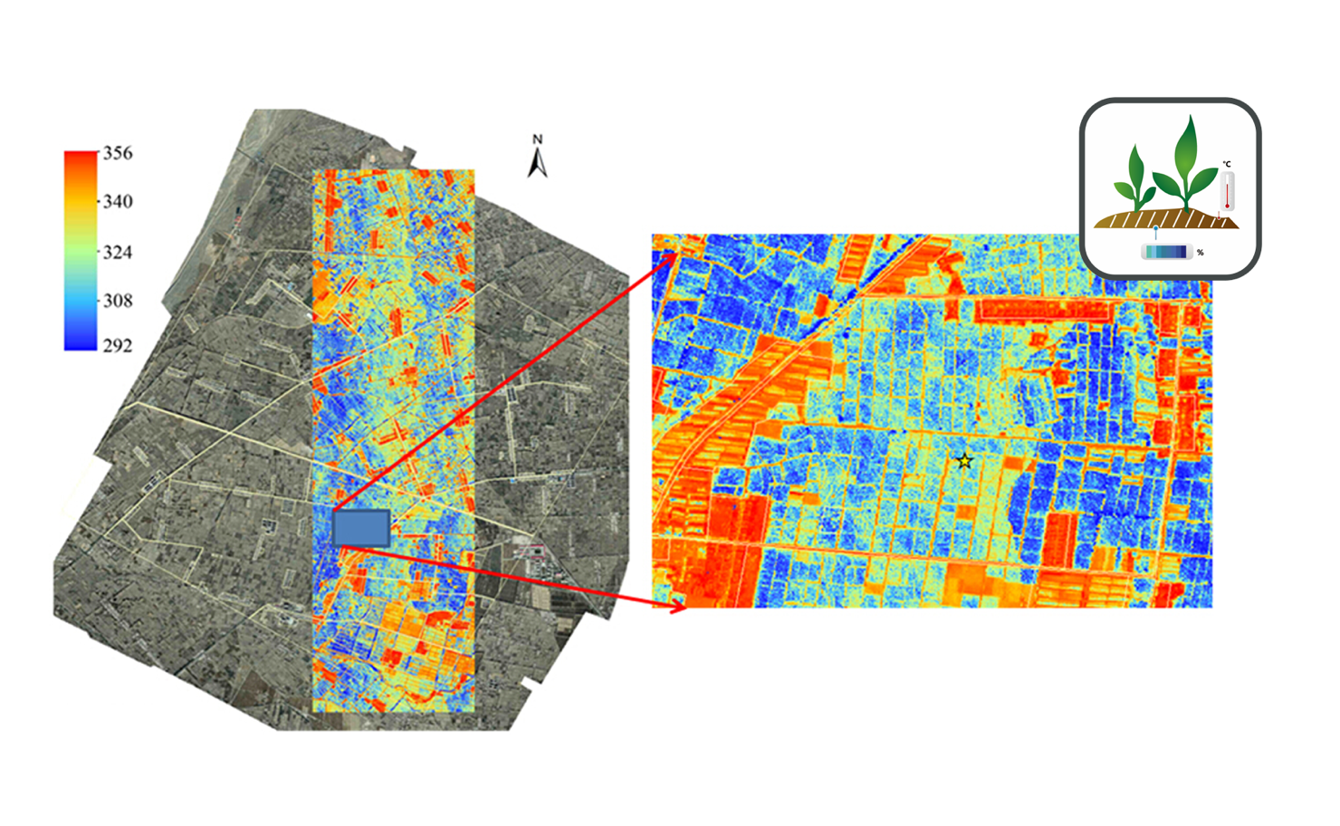
Your Farmland Doctor
| Excellent Performance | Outstanding Design
| Smart Control |
Professional VTOL Unmanned
Aerial Vehicle.